I love being your Mum

I love being your Mum
Showing posts with label Geography. Show all posts

Wednesday, 16 February 2011

Adrian's Field Trip Report : Rimba Ilmu, University of Malaya, Kuala Lumpur

We joined a guided tour of University Malaya's Rimba Ilmu on the 16 February 2011. The guides from the Malaysian Nature Society (MNS) took us through the botanical gardens and we ended up visiting the exhibition hall.

Here's Adrian's report on the field trip:


Walking in Rimba Ilmu
B
y Adrian Ghani

Today we went to a botanical garden. It was a bit like a forest. The guides explained about different plants to us. There was one with flowers from the tree trunk.

We were allowed to touch some seeds and fruits like the til seed and the forest mangosteen


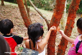
There was also a tree with a red tree trunk and the bark was peeling off like paper

After walking in the garden, we went into the exhibition hall.


Thursday, 27 January 2011

Walking up Vesuvio, Italy

Mount Vesuvius is best known for its eruption in AD 79 that led to the destruction of the Roman cities of Pompeii and Herculaneum. They were never rebuilt, although surviving townspeople and probably looters did undertake extensive salvage work after the destructions. The towns' locations were eventually forgotten until their accidental rediscovery in the 18th century. The eruption also changed the course of the Sarno River and raised the sea beach, so that Pompeii was now neither on the river nor adjacent to the coast. Vesuvius itself underwent major changes – its slopes were denuded of vegetation and its summit changed considerably due to the force of the eruption. Vesuvius has erupted many times since and is today regarded as one of the most dangerous volcanoes in the world because of the population of 3,000,000 people living nearby and its tendency towards explosive eruptions. It is the most densely populated volcanic region in the world

The summit of Vesuvius is open to visitors and there is a small network of paths around the mountain that are maintained by the park authorities. There is access by road to within 200 metres (660 ft) of the summit (measured vertically), but thereafter access is on foot only. There is a spiral walkway around the mountain from the road to the crater.The walk would take a healthy person 25 minutes. Ghani insisted on completing the walk to the crater and huffed and puffed his way up in 45 minutes.

We were given a lift down by the keepers and Adrian was given a volcanic rock from the crater as a souvenir.

Volcano Vesuvio, covered by clouds
Napoli, Italy
20 Nov 08
Adrian runs up the volcanic slopes
Vesuvio, Napoli
20 Nov 08
Ghani huffs and puffs behind
Vesuvio, Napoli
20 Nov
The crater of the Vesuvio, Europe's only active volcano, last erupted in 1944 and thankfully, not today!
Napoli
20 Nov 08
Smoking crater
Vesuvio, Napoli
20 Nov 08
Ghani and Tuah with Guides at Vesuvio
Antonio, Camio and Stefano
Napoli
20 Nov 08
Adrian checks out some volcanic rocks
Vesuvio, Napoli
20 Nov 08

Bedouin Experience in Wadi Rum, Jordan

A Bedouin is any member of a community of Arabic-speaking desert nomads of the Middle East. Ethnically, the Bedouin are identical to other Arabs. Bedouin traditionally have made their living by animal husbandry, and social rank among them is determined by the animals that they herd: camel nomads enjoy the greatest status, followed by sheep and goat herders and, finally, cattle nomads. Traditionally, Bedouin would migrate into the desert during the rainy season and return to cultivated areas during the dry season, but since World War II (1939 – 45) the governments of many countries have nationalized their range lands, and conflicts over land use have arisen. Many Bedouin have since adopted sedentary ways of life; most, however, retain pride in their nomadic heritage.

Wadi Rum also known as The Valley of the Moon is a valley cut into the sandstone and granite rock in south Jordan at 60 Km to the east of Aqaba. It is the largest wadi in Jordan. The name Rum most likely comes from an Aramaic root meaning 'high' or 'elevated'. To reflect its proper Arabic pronunciation, archaeologists transcribe it as Wadi Ramm.

Wadi Rum has been inhabited by many human cultures since prehistoric times, with many cultures — including the Nabateans — leaving their mark in the form of rock paintings, graffiti, and temples. As of 2007, several Bedouin tribes inhabit Rum and the surrounding area. In the West, Wadi Rum may be best known for its connection with British officer T. E. Lawrence aka Lawrence of Arabia, who based his operations here during the Arab Revolt of 1917–18. In the 1980s one of the impressive rock formations in Wadi Rum was named "The Seven Pillars of Wisdom" in memory of Lawrence's book penned in the aftermath of the war, though the 'Seven Pillars' referred to in the book actually have no connection with Wadi Rum.

When we arrived in Wadi Rum, we were pleasantly surprised to meet Hanim Benziane, a Malaysian living in Doha, with her Husband Karim, and kids, Ryan and Louisa. We had a great night camping in the desert and were visited by wild dogs overnight. The next morning however, we got bogged down in the sand and as were were digging our way out, met some Bedouin, in a 4WD who offered to let us attach our winch to their truck, for a fee.

Desert dining
Wadi Rum, Jordan
21 Dec 08
The desert is one big sandpit
Wadi Rum, Jordan
22 Dec 08

Tuah gets bogged down
Wadi Rum, Jordan
22 Dec 08
We need to dig Tuah out of the dunes
Wadi Rum, Jordan
22 Dec 08
Adrian and his Bedouin friend
Wadi Rum, Jordan
22 Dec 08
What's left of what was supposed to be Lawrence of Adrabia's house
Wadi Rum
Jordan
Plants growing in the middle of the desert
Wadi Rum
Jordan
Running wild in the desert
God's idea of a giant sand pit
Wadi Run
Jordan
Nabatean Stone Drawings
Wadi Rum
Jordan

With Hanim, Karim, Louisa and Ryan
Wadi Rum, Jordan

Sleding on the White Sands, NM, USA

Rising from the heart of the Tularosa Basin is one of the world's great natural wonders - the glistening White Sands National Monument of New Mexico. Here, great wave-like dunes of gypsum sand have engulfed 275 square miles of desert and created the world's largest gypsum dune field. White Sands National Monument preserves a major portion of this unique dune field, along with the plants and animals that have successfully adapted to this constantly changing environment.

Unlike dunes made of quartz-based sand crystals, the gypsum does not readily convert the sun's energy into heat and thus can be walked upon safely with bare feet, even in the hottest summer months. In areas accessible by car, children frequently use the dunes for downhill sledding. Sliding downhill is an exhilarating sport. The proper position for sledding is to sit or lay on your back on the top of the sled, with your feet pointing downhill. Sledding head first increases the risk of head injury and should be avoided.

The white sands dune field is an active dune field. The dunes move from west to east as much as thirty feet per year. Many species of plants and animals have developed very specialized means of surviving in this area of cold winters, hot summers, with very little surface water and highly mineralized ground water. Most desert animals are nocturnal, coming out to feed only at night when temperatures are cooler. Every animal in the white sands makes tracks on the dunes as it moves, leaving clues to its nocturnal activities.

Tuah in the White Sands
Alamogardo, NM
11 August 2009
Adrian seeks shelter
White Sands
Alamogardo, NM
11 August 2009
Adrian in the White Sands
Alamogardo, NM
11 August 2009
Adrian in the White Sands
Alamogardo, NM
11 August 2009
Ghani makes his way up the dunes....slowly
White Sands
Alamogardo, NM
11 August 2009
...and he's up...
White Sands
Alamogardo, NM
11 August 2009
....and he's on his way down!
White Sands
Alamogardo, NM
11 August 2009
Ghani, Adriani and Tuah in the White Sands
Alamogardo, NM
11 August 2009
Adrian in a Junior ranger vest and a Park Ranger
White Sands
Alamogardo, NM
11 August 2009

Way Down South : Key West, USA

Key West is an island in the Straits of Florida on the North American continent at the southernmost tip of the Florida Keys.

One of the biggest attractions on the island is a concrete replica of a buoy at the corner of South and Whitehead Streets that claims to be the southernmost point in the contiguous 48 states The point was originally just marked with a sign, which was often stolen. In response to this, the city of Key West erected the now famous monument in 1983. Brightly painted and labeled "SOUTHERNMOST POINT CONTINENTAL U.S.A.", it is one of the most visited and photographed attractions in Key West.

Land on the Truman Annex property just west of the buoy is the true southernmost point, but it has no marker since it is U.S. Navy land and cannot be entered by civilian tourists. The private yards directly to the east of the buoy and the beach areas of Truman Annex and Fort Zachary Taylor Historic State Park also lie farther south than the buoy. The farthest-south location that the public can visit is the beach at the state park for a small entrance fee.

Florida's southernmost point is Ballast Key, a privately owned island just south and west of Key West. Signs on the island strictly prohibit unauthorized visitors. The claim "90 Miles to Cuba" on the monument isn't entirely accurate either, since Cuba at its closest point is 94 statute miles from Key West. Further south than the southernmost point of Florida lies the entire state of Hawaii as well as US territories, with two (American Samoa and Jarvis Island) actually in the Southern Hemisphere.

We spent a wonderful day out on the Florida Keys with Susie Goh, a Malaysian living in Miami, whom we bumped into in Orlando. We were honoured to have been invited to stay in her home during our time in Miami.

Us at the southernmost point on Continental USA
90miles from Cuba
Key West
Miami, FL
12 July 2009
Susie with Adrian at South Beach
Key West, FL
12 July 2009

Tuah at Mile 0
Mile 0 of US Route 1....the road to America begins here!
Key West, FL
12 July 2009
Key West Sunset
Florida
12 July 2009
Adrian finds a spot to prance around
Key West
Miami, FL
12 July 2009

Christmas All Year Round: Rovaniemi, Finland

Santa Claus spends his time at the Santa Claus Village every day of the year to take care of his mission in life; to enhance the wellbeing of children and the kindness of grown-ups, as well as spreading the message love and goodwill of Christmas Spirit throughout the globe.

Rovaniemi is The Official Home of Santa Claus.You can meet Santa Claus and cross the magical Arctic Circle every day at the Santa Claus Village in Lapland. Send friends and relatives greetings from the Santa Claus Main Post Office with the unique Arctic Circle postmark.

When Santa Claus declared Rovaniemi as his hometown, he told how his home at Ear Mountain (Korvatunturi) was revealed at the beginning of the last century and how this closely guarded secret spread the world over. In order to retain the privacy of his secret location, the Elf folk decided to build a place where Santa could meet people from near and far at the Northern Arctic Circle.

For kids and grown ups alike, meeting Santa in his office is a magical experience. On asking us where we had travelled from, Santa greeted us with a cheery, "Selamat Datang". Most impressive!

As we were leaving the village, Ghani, still excited from being interviewed by the local press while Adrian and I were busy writing Christmas Cards (in July, to be posted in December), left his camera on the bumper of the truck. When we were at a red light about 2 km down the road, a little white car drove up along side us and beeped. When we looked, the driver was holding up Ghani's camera, saying we dropped it along the way! The magic of Christmas and goodwill to all men does exist in this place!


On the Artic Circle
Santa's Village, Finland
26 July 2008
Adrian at Santa's Post office,
Finland
26 July 2008
We've hit the Artic Circle
5pm on 26 July 2008
Roviniemi, Finland
Adrian running off to see Santa in his office
Santa's Village
26 July 2008
With Santa at
Santa's Village, Finland
26 July 2008

The Pyramids Of Giza, Egypt

If there was one thing Adrian was looking to, it would have been this - to see the great Pyramids of Giza! He had in fact a little more knowledge about Egypt than Ghani and I did, thanks to the educational DVDs he had been watching in the back seat!

Upon arrival at Giza, we were told that we were too late to enter, as the ticket office had closed 5 minutes before hand. The next morning though, much to his disappointment, Adrian wasn't feeling too well, a side effect from the Lariam, which we just started taking in preparation for the rest of Africa. A good rest helped and we headed out to the Pyramids again after lunch.

Being told we can't go in, as the ticket office closes at 4pm
Giza, Egypt
28 Dec 08
Adrian not feeling too well
Cairo, Egypt
29 Dec 08

Despite being told by several touts along the way that it was forbidden to drive further, as they did everything they could to get us to park Tuah in the car park and take a ride on one of their camels, we carried on, prepared to mow anyone in our way and drove right up to the foot of the Pyramids.

It's certainly a sight to behold and seeing the Sphinx was like meeting an old friend. The Great Pyramid of Giza (also called the Pyramid of Khufu and the Pyramid of Cheops) is the oldest and largest of the three pyramids in the Giza Necropolis bordering what is now El Giza, Egypt. It is the oldest of the Seven Wonders of the Ancient World, and the only one to remain largely intact.

It is believed the pyramid was built as a tomb for fourth dynasty Egyptian Pharaoh Khufu (Cheops in Greek) and constructed over a 20-year period concluding around 2560 BC. The Great Pyramid was the tallest man-made structure in the world for over 3,800 years. Originally the Great Pyramid was covered by casing stones that formed a smooth outer surface; what is seen today is the underlying core structure. Some of the casing stones that once covered the structure can still be seen around the base.

There have been varying scientific and alternative theories about the Great Pyramid's construction techniques. Most accepted construction hypotheses are based on the idea that it was built by moving huge stones from a quarry and dragging and lifting them into place.

There are three known chambers inside the Great Pyramid. The lowest chamber is cut into the bedrock upon which the pyramid was built and was unfinished. The so-called Queen's Chamber and King's Chamber are higher up within the pyramid structure. The Great Pyramid of Giza is the only pyramid in Egypt known to contain both ascending and descending passages. The main part of the Giza complex is a setting of buildings that included two mortuary temples in honor of Khufu (one close to the pyramid and one near the Nile), three smaller pyramids for Khufu's wives, an even smaller "satellite" pyramid, a raised causeway connecting the two temples, and small mastaba tombs surrounding the pyramid for nobles.


Adrian's been wanting to see the Pyramids for the last 3 weeks! Finally, the day has come!
Giza, Egypt
29 Dec 08
It's a little bigger than I thought...
Adrian at the Pyramids
Giza, Egypt
29 Dec 08
My pyramid is a lot smaller than the one over there..
Adrian at the Pyramids
Giza, Egypt
29 Dec 08
Tuah has made it all the way to the Pyramids
Giza, Egypt
29 Dec 08
Ghani gets a camel kiss
Giza, Egypt
29 Dec 08
We put up with the madness of Cairo to see the last standing wonder of the ancient world...it was the one thing that Adrian had looked forward to for weeks and his happiness made it all worth it!
Giza, Egypt
29 Dec 08